| dc.contributor.author | DÖNMEZ, Ergin; TİRYAKİOĞLU, İbrahim | |
| dc.date.accessioned | 2019-01-17T08:00:03Z | |
| dc.date.available | 2019-01-17T08:00:03Z | |
| dc.date.issued | 2018 | |
| dc.identifier.citation | | en_US |
| dc.identifier.uri | http://fenbildergi.aku.edu.tr/wp-content/uploads/2018/12/015805-1110-1117.pdf | |
| dc.identifier.uri | http://hdl.handle.net/11630/5133 | |
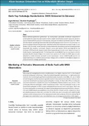
| dc.description | Observing and investigating the earth crust deformations are highly important tolls in the study of
potential earthquakes in the future. Today, the method of geodetic networking is a highly preferred
method in the monitoring of superficial crustal deformations. Especially in the 1980s, the use of GNSS
(Global Navigation Satellite Systems) in geodetic network measurements has made this method quite
convenient. Gediz fault has produced great earthquakes in history. On March 28, 1970, an earthquake
occurred in Gediz that is located in the west of central Kütahya. Western Anatolia was shaken in the
earthquake. After the earthquake, a 40 km long fault was broken. Since the earthquake known as the
Great Gediz earthquake of 1970, no major earthquakes have occurred until in the region. When the
historical earthquakes are examined, the longest earthquake generation period of the fault is 48 years.
A 21-point GNSS network was established around the district of Gediz and the network has been
periodically measured in 2016, 2017, and 2018. The GNSS data were evaluated with GAMIT/GLOBK
software and the velocity vectors of the measurement points were produced. When the velocity field of
the region was examined, it was seen that there was an energy accumulation i n the region. | en_US |
| dc.description.abstract | Kabuk deformasyonlarının gözlenmesi ve incelenmesi gelecekte olabilecek depremlerin
potansiyellerinin araştırılmasında hayati bir öneme sahiptir. Günümüzde jeodezik ağ kurma yöntemi
yüzeysel kabuk deformasyonlarının izlenmesinde, oldukça tercih edilen bir yöntemdir. Özellikle 1980’li
yıllardan itibaren jeodezik ağ ölçümünde GNSS (Küresel Navigasyon Uydu Sistemleri) kullanılması bu
yöntemi oldukça kullanışlı hale getirmiştir. Gedizfayı tarihte büyük depremler üretmiş bir faydır. En son
28 Mart 1970 tarihinde, merkezi Kütahya'nın batısındaki Gediz yöresinde bir deprem meydana gelmiştir.
Depremde Batı Anadolu sarsılmıştır. Deprem sonrasında toplam 40 km uzunluğunda bir fay
kırılmıştır.1970 Büyük Gediz depremi olarak bilinen depremden günümüze kadar fayda herhangi bir
büyük deprem meydana gelmemiştir. Tarihsel depremler incelendiğinde fayın en uzun deprem üretme
periyodu 48 yıldır. Çalışma bölgesi olan Gediz ilçesi çevresine 21 noktalı bir GNSS ağı kurularak
2016,2017 ve 2018 yıllarında periyodik olarak ölçülmüştür. Veriler GAMIT/GLOBK yazılımı ile
değerlendirilmiş ve hız vektörleri oluşturulmuştur. Bölgeye ait hız vektörleri incelendiğinde bölgede bir
enerji birikiminin olduğu görülmüştür. | en_US |
| dc.language.iso | tur | en_US |
| dc.identifier.doi | 10.5578/fmbd.67776 | en_US |
| dc.rights | info:eu-repo/semantics/openAccess | en_US |
| dc.subject | GNSS; Gediz Fayı; GAMIT/GLOBK | en_US |
| dc.title | Gediz Fayı Yerkabuğu Hareketlerinin GNSS Gözlemleri ile İzlenmesi | en_US |
| dc.title.alternative | Monitoring of Tectonics Movements of Gediz Fault with GNSS Observations | en_US |
| dc.type | article | en_US |
| dc.relation.journal | Fen ve Mühendislik Bilimleri Dergisi | en_US |
| dc.department | Afyon Kocatepe Üniversitesi | en_US |
| dc.identifier.volume | 18 | en_US |
| dc.identifier.startpage | 1110 | en_US |
| dc.identifier.endpage | 1117 | en_US |
| dc.identifier.issue | 3 | en_US |
| dc.relation.publicationcategory | Makale - Ulusal Hakemli Dergi - Kurum Yayını | en_US |


