| dc.contributor.author | Toydemir, Tolga | |
| dc.contributor.author | Tiryakioğlu, İbrahim | |
| dc.contributor.author | Baybura, Tamer | |
| dc.contributor.author | Uğur, Mehmet Ali | |
| dc.contributor.author | Solak, Halil İbrahim | |
| dc.date.accessioned | 2023-09-07T12:17:51Z | |
| dc.date.available | 2023-09-07T12:17:51Z | |
| dc.date.issued | 31.12.2021 | en_US |
| dc.identifier.citation | Toydemir, T. , Tiryakioğlu, İ. , Baybura, T. , Uğur, M. A. & Solak, H. İ. (2021). Afyon Akşehir Grabeninde Jeodezik Yamulma Alanları ile b Parametresi Arasındaki İlişkilerin Belirlenmesi . Afyon Kocatepe Üniversitesi Fen Ve Mühendislik Bilimleri Dergisi , 21 (6) , 1366-1376 . DOI: 10.35414/akufemubid.1001334 | en_US |
| dc.identifier.uri | https://dergipark.org.tr/tr/download/article-file/1996888 | |
| dc.identifier.uri | https://hdl.handle.net/11630/10798 | |
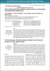
| dc.description.abstract | Akşehir-Simav Fay Sistemi (ASFS) Batı Anadolu genişleme bölgesinde yer almakta olup en önemli sismojenik kuşaklardan biridir. Sistem içerisinde yer alan oblik/eğim atımlı normal fay segmentlerinden dolayı çok sayıda horst ve graben türü yapılar bulunmaktadır. Bu çalışma kapsamında ASFS’nin AfyonAkşehir Grabeni (AAG) kısımda 27 noktalık bir GNSS ağı kurulmuş ve 2012-2018 yılları arasında 5 kampanya GNSS ölçüsü gerçekleştirilmiştir. Elde edilen veriler GAMIT/GLOBK yazılımı değerlendirilmiş ve tüm noktaların Avrasya plakası sabit hızları hesaplanmıştır. Hız alanı kullanılarak, GEODSUIT yazılımı bölge yamulma alanları (strain) hesaplanmış ve sonuçlar deprem verileri yardımıyla hesaplanan b parametreleri karşılaştırılmıştır. Elde edilen bulgular 2002 Çay-Eber depremlerinden sonra bölgenin batısına doğru jeodezik yamulmaların arttığını göstermektedir. | en_US |
| dc.description.abstract | Akşehir-Simav Fault System (ASFS) is one of the most important seismojenic zones in the Western Anatolia Extensional Zone. Because of oblique-slip normal fault segments, it contains many parallel horst and graben type structures. This study was carried out with GNSS measurements obtained from 27 GNSS points established in the Afyon-Akşehir Graben (AAG) part of ASFS. GNSS measurements were carried out as 5 campaigns between 2012 and 2018. As a result of the evaluation of the GNSS data using GAMIT/GLOBK software, the velocity vectors fixed to Eurasian plate of the sites were calculated. The strain rates computed with GEODSUIT software, and the b parameters calculated using earthquake data. Based on the comparisons of the strain rates and b parameters, the study results show that after the 2002 Çay Eber earthquakes, the geodetic strains increased towards the west of the region. | en_US |
| dc.language.iso | tur | en_US |
| dc.publisher | Afyon Kocatepe Üniversitesi | en_US |
| dc.identifier.doi | https://doi.org/10.35414/akufemubid.1001334 | en_US |
| dc.rights | info:eu-repo/semantics/openAccess | en_US |
| dc.subject | Afyon Akşehir Grabeni | en_US |
| dc.subject | GNSS | en_US |
| dc.subject | GAMIT/GLOBK | en_US |
| dc.subject | B Parametre | en_US |
| dc.subject | Yamulma Alanı | en_US |
| dc.subject | B Parameter | en_US |
| dc.subject | Strain Field | en_US |
| dc.title | Afyon Akşehir grabeninde jeodezik yamulma alanları ile b parametresi arasındaki ilişkilerin belirlenmesi | en_US |
| dc.title.alternative | The determination of relations between geodetic strain field and b parameter in Afyon Akşehir graben | en_US |
| dc.type | article | en_US |
| dc.relation.journal | Fen ve Mühendislik Bilimleri Dergisi | en_US |
| dc.department | Fakülteler, Mühendislik Fakültesi, Harita Mühendisliği Bölümü | en_US |
| dc.authorid | 0000-0002-4954-7109 | en_US |
| dc.authorid | 0000-0002-8164-534X | en_US |
| dc.authorid | 0000-0002-9067-2964 | en_US |
| dc.authorid | 0000-0002-2741-900X | en_US |
| dc.authorid | 0000-0001-5286-0369 | en_US |
| dc.identifier.volume | 21 | en_US |
| dc.identifier.startpage | 1366 | en_US |
| dc.identifier.endpage | 1376 | en_US |
| dc.identifier.issue | 6 | en_US |
| dc.relation.publicationcategory | Makale - Ulusal Hakemli Dergi - Kurum Öğretim Elemanı | en_US |
| dc.contributor.institutionauthor | Tiryakioğlu, İbrahim | |
| dc.contributor.institutionauthor | Baybura, Tamer | |
| dc.contributor.institutionauthor | Uğur, Mehmet Ali | |
| dc.contributor.institutionauthor | Solak, Halil İbrahim | |


