| dc.contributor.author | AYDIN, Cüneyt; AYKUT Nedim Onur; AKPINAR, Burak | |
| dc.date.accessioned | 2019-01-15T11:42:24Z | |
| dc.date.available | 2019-01-15T11:42:24Z | |
| dc.date.issued | 2018 | |
| dc.identifier.citation | | en_US |
| dc.identifier.uri | http://fenbildergi.aku.edu.tr/wp-content/uploads/2018/09/015506-605-615.pdf | |
| dc.identifier.uri | http://hdl.handle.net/11630/5108 | |
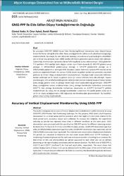
| dc.description | This study investigates the accuracy of vertical displacement (subsidence or uplift) monitored by using
GNSS-PPP (GNSS-Precise Point Positioning) technique. For this purpose, GNSS (static) dual-frequency
observations for an initial period and five periods in which the heights of a test point relative to the
initial period were accurately known were collected. To increase the reliability, the experiment
including six periods was repeated three times in different conditions at the same point. GNSS
observations were processed with the use of online CSRS-PPP service for different observing-session
durations from T=2 hoursto T=12 hours in 4 different cases, namely, (1) GPS-PPP observation type-final
orbit, (2) GPS/GLONASS observation type-final orbit, (3) GPS-PPP observation type-rapid orbit, and (4)
GPS/GLONASS observation type-rapid orbit. The estimated and known vertical displacements between
the periods are compared to determine the root mean square (RMS) error of PPP technique in
monitoring of vertical displacements for each case and session duration. According to our analyses, the
RMS errors of GPS and GPS/GLONASS are almost equivalent to each other and can be defined
depending on the type of orbital coordinates and the session duration: The RMS error of GNSS-PPP is
3.9/(T
0.5) and 4.2/(T
0.5) [cm/hour0.5] for final and rapid orbits, respectively. This result shows that
vertical displacements of about 6 cm can be detected with the 80% power of the test for both orbit
types when T=4 hours data are collected in the field. As a corollary, this detectable magnitude decreases
while session duration increases. | en_US |
| dc.description.abstract | Bu çalışmada GNSS–PPP (GNSS-Precise Point Positioning/Küresel Konumlama Uydu Sistemi-Hassas
Konum Belirleme) tekniği ile elde edilen düşey yerdeğiştirmenin (çökme ya da yükselmenin) doğruluğu
incelenmektedir. Bu amaçla, bir test noktasında başlangıç periyoduna ve bu periyoda göre yükseklikleri
çok iyi bilinen beş periyoda ilişkin GNSS (statik) çift frekans gözlemleri günlük olarak elde edilmiştir.
Güvenilirliği arttırmak için 6 periyotluk deney farklı koşullarda üç kez tekrarlanmıştır. GNSS gözlemleri
T=2 saatlikten T=12 saatliğe kadar değişen süreler için 4 farklı durumda (1: GPS-PPP gözlemi-sonuç
yörünge; 2: GPS/GLONASS gözlemi-sonuç yörünge; 3: GPS-PPP gözlemi-hızlı yörünge, ve 4:
GPS/GLONASS gözlemi-hızlı yörünge) CSRS (Canadian Spatial Reference System)-PPP internet servisi
yardımıyla değerlendirilmiştir. Söz konusu 4 farklı durum ve gözlem süreleri için periyotlar arasındaki
gözlenen ve bilinen düşey yerdeğiştirmeler karşılaştırılmıştır. Karşılaştırmalar sonucunda belirlenen
hatalar yardımıyla her bir durum ve gözlem süresi için karesel ortalama hata elde edilmiştir. Yapılan
analizlere göre, GPS ve GPS/GLONASS gözlem türlerine ilişkin karesel ortalama hataların hemen hemen
özdeş olduğu, gözlem süresi ve yörünge türüne bağlı olarak açıklanabileceği görülmüştür. GNSS-PPP
düşey yerdeğiştirme karesel ortalama hatası, sonuç yörünge koordinatları kullanılması durumunda
3.9/(T
0.5), hızlı yörünge koordinatları kullanılması durumunda ise 4.2/(T
0.5) [cm/saat0.5] şeklinde
modellenmiştir. Bu sonuç, her iki yörünge koordinatları kullanılarak T=4 saatlik gözlem süresi için 6
cm’lik bir düşey yerdeğiştirmenin %80 doğrulukla belirlenebileceğini göstermektedir. Bu büyüklük,
gözlem süresi arttıkça küçülmektedir. | en_US |
| dc.language.iso | tur | en_US |
| dc.identifier.doi | 10.5578/fmbd.67452 | en_US |
| dc.rights | info:eu-repo/semantics/openAccess | en_US |
| dc.subject | Doğruluk, Düşey Yerdeğiştirme, GNNS, Hassas Konum Belirleme | en_US |
| dc.title | GNSS-PPP ile Elde Edilen Düşey Yerdeğiştirmenin Doğruluğu | en_US |
| dc.title.alternative | Accuracy of Vertical Displacement Monitored by Using GNSS-PPP | en_US |
| dc.type | article | en_US |
| dc.relation.journal | Fen ve Mühendislik Bilimleri Dergisi | en_US |
| dc.department | Afyon Kocatepe Üniversitesi | en_US |
| dc.identifier.volume | 18 | en_US |
| dc.identifier.startpage | 605 | en_US |
| dc.identifier.endpage | 615 | en_US |
| dc.identifier.issue | 2 | en_US |
| dc.relation.publicationcategory | Makale - Ulusal Hakemli Dergi - Kurum Yayını | en_US |


