| dc.contributor.advisor | Babacan, Hasan | |
| dc.contributor.author | Kündeyi, Mustafa Abdullah | |
| dc.date.accessioned | 2015-03-27T12:39:16Z | |
| dc.date.available | 2015-03-27T12:39:16Z | |
| dc.date.issued | 2009 | |
| dc.date.submitted | 2009 | |
| dc.identifier.uri | http://hdl.handle.net/11630/3485 | |
| dc.description.abstract | Hüdavendigar Eyaleti Karahisar-ı Sahib Sancağı sınırları dahilinde bulunan Karamık Kazası’nın XIX. Yüzyıl ortalarındaki sosyo-ekonomik ve demografik yapısı ele alınmıştır. Kullanılan temel kaynak, Temettuât Defterleri (ML_VRD_TMT_d_ 08380-6) olup inceleme sonucunda Karamık kazasına ait (1844-45 M.) demografik yapısı, tarım ve hayvancılık ile ilgili faaliyetleri ve bunlardan elde edilen gelirler ve vergilerin tespit edilmesi amaçlanmıştır.
Karamık, Afyonkarahisar ili Çay İlçesi sınırlarında yer alan; Osmanlı döneminde idare merkezi ve ticaret yolları güzergahında bulunan, kesin olmamakla birlikte Miryakefalon savaşının yapıldığına dair iddiaların olduğu bir yerleşim yeridir. Tezimizde Karamık’ın nüfus, tarım arazileri, tarımsal üretim, hayvan sayıları gibi bilgilerle birlikte, meslekler, sülaleler ve ödenen vergi miktarlarının da tespit edilmesi amaçlanmıştır. Elde edilen tespitlere göre bu dönemde Karamık, tarım ve hayvancılıkla uğraşan ve belgelerden de anlaşılacağı üzere nüfusunun tamamı Müslüman olan
Osmanlı kazasıdır. | en_US |
| dc.description.abstract | In this study, the socioeconomic and demographic structure of Karamik Township, which is located within the boundaries of Sahib-i Karahisar Sanjak, in the province of Hudavendigar, has been examined. The main resources of this study are temettuat registers (ML_VRD_TMT_d_ 08380-6) in the Ottoman Archives. By examining these registers, it is aimed to determine the demographic structure of Karamik Township, its activities on agriculture and animal husbandry, and the revenues and taxes paid for these activities in 1844.
Karamik, located within the boundaries of Çay Province in Afyonkarahisar, is a settlement which is on the trade routes and an administrative center during the Ottoman period. Although it is indefinite, there are some claims that the Battle of Myriokephalon, a battle between the Byzantine Empire and the Seljuk Turks in Phrygia on September 17, 1176, took place in Karamik district. The aim of this study is to determine the demographic structure, agricultural lands, agricultural production, the number of animals, occupations, families, and the amount of taxes paid in Karamik Township. According to the information gathered, Karamik is an Ottoman township with a whole population of Muslims who are engaged in agriculture and animal husbandry in the above mentioned period. | en_US |
| dc.language.iso | tur | en_US |
| dc.publisher | Afyon Kocatepe Üniversitesi, Sosyal Bilimler Enstitüsü | en_US |
| dc.rights | info:eu-repo/semantics/openAccess | en_US |
| dc.subject | Tarih | en_US |
| dc.subject | Karamık | en_US |
| dc.subject | Temettuat | en_US |
| dc.subject | Ekonomi | en_US |
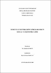
| dc.title | Temettuat Defterlerine Göre Karamık’ın Sosyal ve Ekonomik Yapısı | en_US |
| dc.title.alternative | According to the Temettuât Registers the Socioeconomic Structure of Karamik Townshıp | en_US |
| dc.type | masterThesis | en_US |
| dc.department | Afyon Kocatepe Üniversitesi, Sosyal Bilimler Enstitüsü, Tarih Anabilim Dalı | en_US |
| dc.relation.publicationcategory | Tez | en_US |


